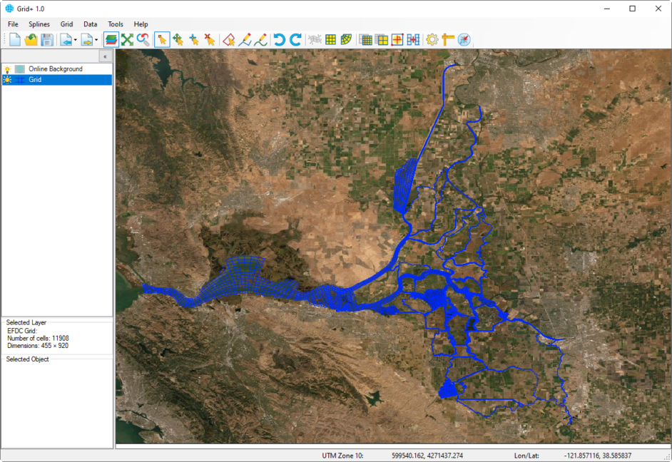
Grid Building
EFDC+ and other hydrodynamic models such as ECOM, CH3D, and DELFT3D all require 2D curvilinear orthogonal or Cartesian grids. Grid+ has been designed as a tool to support the building of these grids quickly and effectively. Grid+ can be used to produce very complex grids (such as the San Joaquin-Sacramento River Delta below) and very large grids (>500,000 cells). Grid+ is the next generation of our tools after CVLGrid, with many features that allow users to be more efficient in grid building including creation of rectangular and radial grid forms, numerous shortcut keys.
Background Images
To make building a grid as simple and physically representative as possible, Grid+ displays dynamic online background maps. Different maps are available and projected with lat/long coordinates. For those who are working offline, Grid+ offers the option of loading background bitmap images, including georeferenced Google Earth images, to display maps of the model domain.
Optimized for EFDC
Because all EFDC models require 2D curvilinear orthogonal grids, this grid-building tool has been optimized for use with EFDC+, EFDC_EPA, and EFDC_Hydro. When working with EE Modeling System (EEMS), the fact that Grid+ is an integrated part of the system makes the grid-building process even faster and allows you to iterate and make edits easily.
Grid Creation Tools
Once you have your background image and overlay files displayed, Grid+ has a range of tools to create your grid. Using the georeferenced data, you can build a series of discrete blocks, then connect them each in turn, building your grid. Grid resolution, IJ orientation, orthogonality, etc. are all available to iterate upon as needed. You’ll find the extensive Undo/Redo capability to be extremely useful during grid building.
Grid/Model Import Tools
Grid+ allows you to import grids from existing models, including practically any legacy EFDC model, ECOM, and CH3D models. Once imported, you can edit and refine the grid and save the revised grid out as a new EFDC+ model or in the grid format native to Grid+.
Overlay Tools
You can import, export, and edit a variety of third-party overlay and land boundary files to help visualize your model domain and guide you during the grid-building/editing process.
RGF Grid, AutoCad DXF files, and ESRI Shape files are some of the third-party files that are supported.